blah blah blah
Pine Flats Gorge and Smarts Brook Cascade
Length: 3.3 mile loopDifficulty (click for info): Beginner
Elevation Gain: 500 feet (loop total)
Rating (click for info): 6/10
Height: 10'
Source: Smarts Brook
Driving Directions:
Trailhead and parking area are on Rt. 49 in Thornton, NH (the cascade is in Sandwich). It is on the right side of the road, 4.0 miles northeast of the traffic light at Rt. 175. Look for a wide lot with two entrances right after Smarts Brook crosses under the road. Click here for a Google map.
About the Hike:
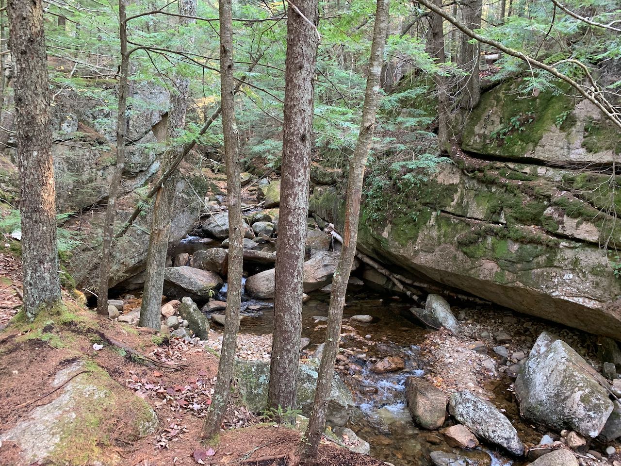
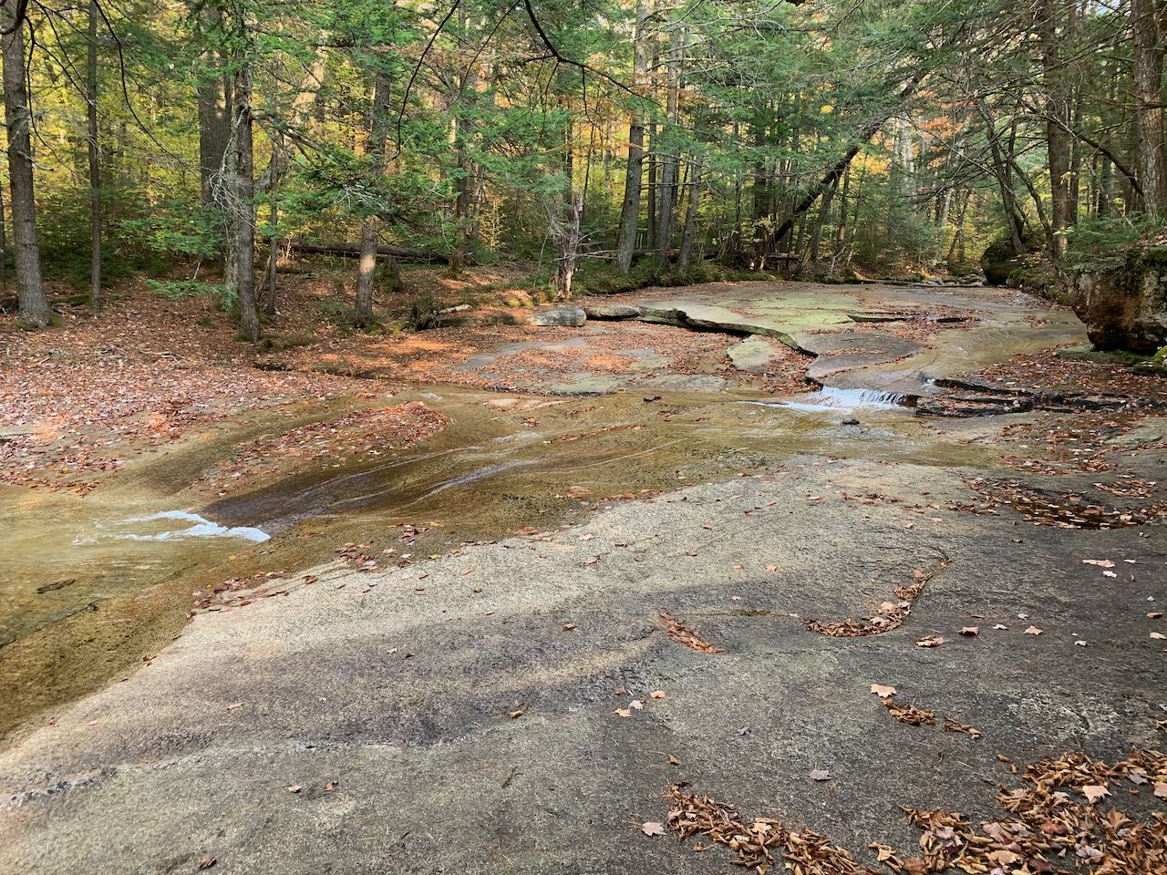
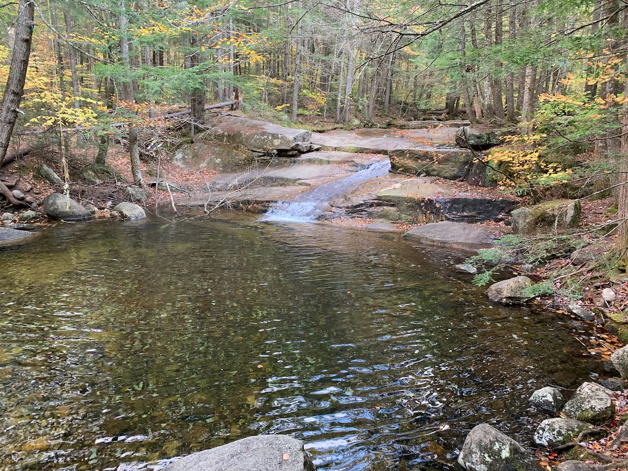
One of the moderately busy trailheads on the road into Waterville Valley is the Smarts Brook Trailhead. It has access to a nice network of walking and biking trails, centered around Smarts Brook. The brook has a surprising amount of scenery for the flat area it's located in. Closest to the road is the Pine Flats Gorge, with an oxymoronic name that perfectly describes how an impressive crevasse betrays the gentle nature of the landscape. Mossy rock walls and boulders are the sights to see in this captivating and little known attraction. By making use of some connecting trails, you can fashion a nice walking loop through the cheery forest to the next feature, a little further in the woods. Smarts Brook Cascade, while not majestic in volume, is a pretty, low-angle waterslide with a spacious pool at the base that's quite a draw for swimming in the summer.
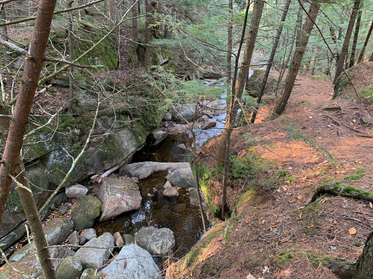
To start your adventure to both of these, head to the right side of the parking area (stay on the near side of the brook) and follow the Pine Flats Trail into the woods. You'll soon approach Smarts Brook and follow close alongside it. Bear right at 0.1 miles as Old Waterville Road, a trail built from the historic route of settlers into the valley, goes to the left. The pine needle-carpeted trail climbs up the bank of the brook as the walls around it rise into a serious gorge. The trail leads along the top of the layered rock wall, offering views down the sheer drop into the brook below, itself cascading through boulders. The gorge walls vary in size as you follow the brook further. At one point, both walls of the gorge fade out and you follow the stream for a bit, then another section of high rock walls follows. Mid-way through the gorge section, 0.15 miles past the last junction, a connecter trail from Old Waterville Road comes in from the left. The trail continues along the brook for another 0.2 miles, treading over roots as the top of the gorge is coated in a carpet of moss off to the side of the trail. It then climbs up a ridge away from the brook and leads through a narrow corridor of stout spruce trees. It stays level at the low elevations, still not too far away from Rt. 49. The trail descends to a junction with Yellow Jacket Trail after 0.3 miles. Turn right.
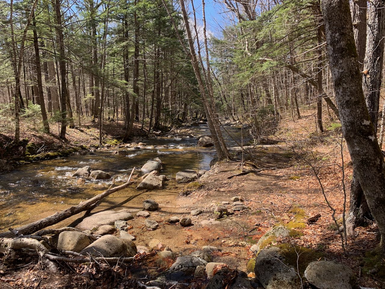
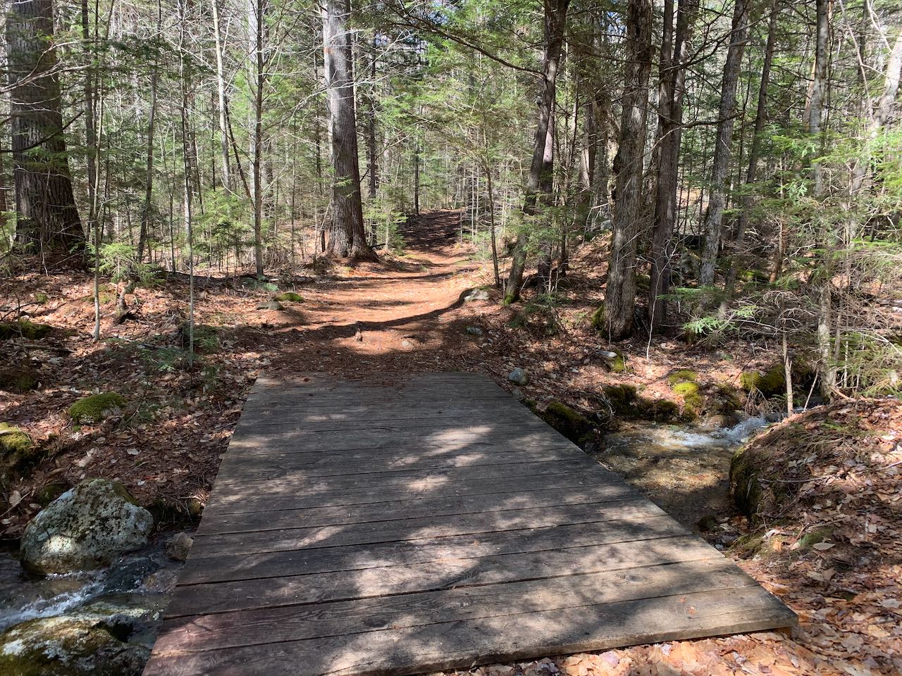
The trail heads slightly uphill beside a stream, crossing a smaller seasonal stream on a wooden bridge. It soon leads away from the stream and crosses another bridge after 0.4 miles. The trail continues to explore the bottom of the valley around Acteon Ridge, strolling across mellow terrain. After a quarter mile, it joins up with Smarts Brook again and follows it closely past a few cascades and rapids. The stream remains your companion for the next 0.45 miles, making for some delightful woods walking. Smarts Brook becomes wider and shallower, and at the far end of your loop, the trail crosses it on a wooden bridge, providing nice views up and down the solid ledge bed of the brook. Just on the other side, Yellow Jacket Trail ends at Smarts Brook Trail, a wide woods road in this section. Take a right and start heading back on this trail. Pass Tri-Town Trail on the left after 0.1 miles and look for a spur on the right about 0.05 after. You'll find a long, low-angle cascade over a smooth ledge ramp into a great pool. The Smarts Brook Trail continues to follow the stony brook closely. In a tenth of a mile, you'll come to the actual Smarts Brook Cascade, just off the side of the trail. It's a little bit steeper as it slides down the ledge and has a deeper pool. The pool ripples out from where the sheet of water enters. The trail parallels the brook, with occasional views down to it, for about 0.3 miles as you head back, and then it leads away. The forest road remains on flat terrain as it swings around the slopes of a little hill. In another half mile, stay left at a fork where a cross-country ski trail splits off downhill. Not far beyond, at the junction where Tri-Town Trail rejoins, turn right, leaving the forest road onto a regular trail. Downhill a bit, the trail rejoins with the ski trail and leads 0.2 miles back out toward the trailhead. As you come out to Rt. 49, turn right and walk over Smarts Brook back to the parking area.
Printable directions page